MRO CTX Example
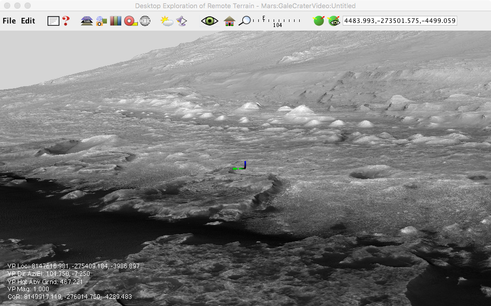
The Context Camera (CTX) rides aboard NASA's Mars Reconnaissance Orbiter (MRO). This camera has a resolution of 6 meters/pixel.
Data Credit: NASA/JPL-Caltech/MSL Science Team
This digital terrain model contains some HiRISE elements as well as CTX.
-
Download the files MSL_Gale_DEM_Mosaic_1m_v3.tif and MSL_Gale_Orthophoto_Mosaic_25cm_v3.tif from https://astrogeology.usgs.gov/search/map/Mars/MarsScienceLaboratory/Mosaics/MSL_Gale_DEM_Mosaic_10m.
-
The width of the DEM is slightly over the power of 2 value of 32768 so we will crop it to save disk space.
gdal_translate -projwin 8128099.493 -244781.075 8160867.493 -302221.075 MSL_Gale_DEM_Mosaic_1m_v3.tif dem.tif
- Crop the orthoimage too.
gdal_translate -projwin 8128099.493 -244781.075 8160867.493 -302221.075 MSL_Gale_Orthophoto_Mosaic_25cm_v3.tif orthoimage.tif
- Create the elevation layer.
layerfactory -type=elevation -file=dem.tif -tilesize=128 -missing=-32767 -landscape=MSL
- Create the orthoimage layer.
layerfactory -type=grayimage -file=orthoimage.tif -tilesize=512 -landscape=MSL
- View the landscape in DERT